Sunday, October 21, 2012

Big Woods State Park & Lake Elmo Scuba


This weekend was average. Two days, two activities. Both fun in their own way but each was just short of great. I'm not thrilled to post ether but together there is enough content for a short story and it's worth the effort for the historical footnote it plays in 3 of our lives, 4 with Scooby.


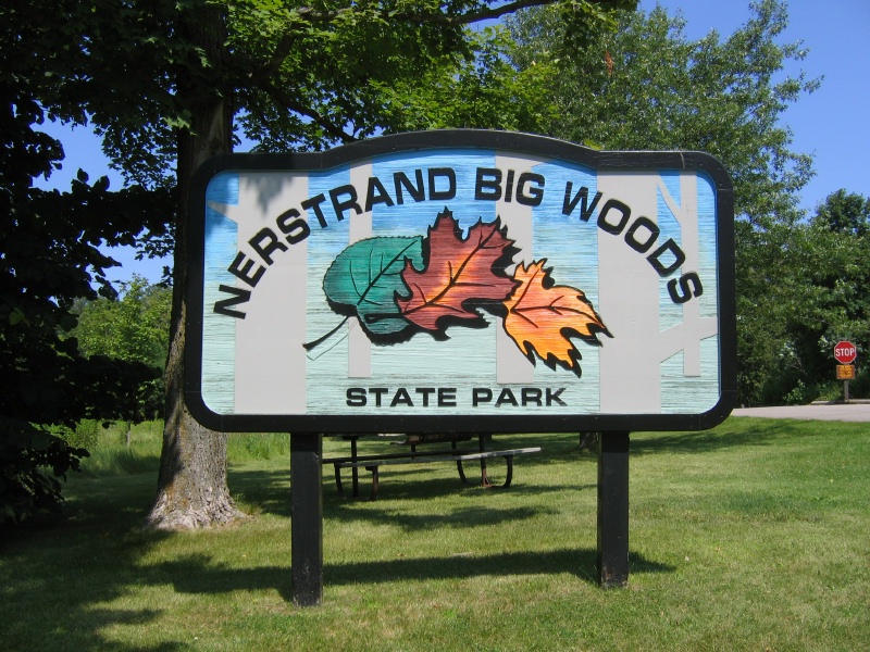
BigWoods State park is a short 50 minute drive south of the cities. Its popular with photographers for it's wild flowers and large tracks of original growth hardwoods. They have a well defined set of hiking trails, mowed wide and reasonable length. Not too long or to short. Many parks have overly long loop trails like 8 miles or so. That could take close to 4 hours. Nerstrand has several 1 miles spurs so we link up Hidden Falls Tail - Beaver trail - Fawn - Hope Loop and that connect back to Beaver and we return on Hidden Falls for a 4.5 mile route.


Hidden Falls is the primary attraction and I'm sure it can be very impressive but it's almost dried up. I thought it was cool the way it was. I get distracted playing with the waterproof camera and seeing how the falls isn't more then a trickle I start making it more then it is.


I didn't hold my breath but I did put my camera down as far as I could to get these. I like both.

As a diver that enjoys local lakes I see this quite often but I don't carry a camera on a dive so maybe this is in some small way, a way to share what I see from under.
Scooby gets an impromptu lesson in rock climbing. He has a leash that is well suited to hold him is he slips a little. He takes to it with great energy but doesn't understand how to keep his center of gravity low and takes a short fall but I catch and he reconnects with the rock and powers on to the top, this time he stays low.

I think he enjoyed it. He liked running in the river on top a great deal.


Below: At the back of the Hope trail we find a table and take a break to heat up some Cider and have a small cookie snack.

The stove is a beer can stove. It burns alcohol. It's lit and heating our cider beverage on the left but you can't see the flame. I'm learning how to deal with that in daylight so this is more for learning then needing a hot drink but it goes down easy. Below: That stove is lite and has a 6 inch flame!


Lets get out of the wood and over to Lake Elmo for a scuba with my good buddy Terry and his lady friend, Cat.

I'm on the right; I don't recall why I'm so serious. I'm putting my glove on so that explains the odd pose.
 Snacks between dives. Jerky, Nuts and Oatmeal cookies.
 I jump off the back and lose my mask. I've jump off a boat 100's of times and today, I lose my scuba mask. Terry goes to find it, if he can in the silt about 26 feet below me. I float around for a few minutes and think, "How could I lose it?" and search around behind my head and find it! It caught on my tank valve and was between my tank and BC (that's a rig I wear to control my buoyancy). I go down to get Terry and after some confusing hand waves we are off to look around. We find a 22 inch plastic conduit that we believe is a gas line. We follow it for a few 100 feet but at 70 feet deep we turn around and follow it to shore. Its unmarked but there are two old post that must have held signs at some point in the recent past.
Scuba is exhausting so I air up my suit and drift. It's  so nice out I didn't want to come out but they told me a tow was out of the question.
I don't normally recover old junk but for the post I pull three cans that are common. We pass 100's of them sunk in the 70 when people didn't think so much about throwing stuff in lakes.

This is North Star Beer.
 I took this because it says "NO OPENER NEEDED" That's awesome. Before them you needed to use a can opener.

We always find anchors. This little guy may be the smallest I've ever found. Maybe 5 pounds. New. It still has a label on it.


We get off the lake just before sundown and now it's about 11:30 pm. I would like to re-author to get better content and story but I don't have the energy and it's only a historical footnote after all. Next weekend looks like it has more possibilities.

Friday, October 19, 2012

2+2+2+1

Two activities, Two weekends, Two locations

One post

We are out on our fat bikes bashing around one weekend and the next weekend on foot. I'll speak briefly about each and then lump up on the couch. I've had some rides in between and a scuba dive out in Tonka that were fun for me but nothing for a reader. I have a few photos I want to share or this would not make it either.


Top Left: Under a bridge. The tagging is nice and bright. I have no idea what it means. I'm sure it's not meant for a couple crackers from the burbs so I don't bother to try and figure it out.

Left: The woods of Savanna Portage.
I wish I took more pics because I'm going back for a winter camp and the summer vs. winter photos may be fun

Below: In a most unusual way we find a potato digger in the woods. This park must have been a farm.

 Scooby is on an adventure hike as well. He enjoys dog toys that have squeakers so to find 'dog toys' that squeak and run away is too much and he loses his mind for chipmunks.

 The colors are good.

We hike about 4 miles out to a lake and a remote camp. Talk to a solo canoeist on an overnight about the location and get some information about how to portage in and not hike 4 miles. I forgot to take the pictures of the permanent shelter and the tiny dock.

Back in the cities we go bash around and with the drought we cross the mud and get to places I've wanted to for about a year.


This was not me but what a fun thing to do. The scale is a little off but the blocks are 9 inches thick and the wall is close to 3 feet. I expect this to be the work of Josh & Sons Adventure but I'm told it is not.    


My hand in the dried mud to show it's 9 to 10 inches deep and 2 to 3 inches wide. Far too wide for any bike but a fat 3.8 or greater. For that, it was smooth rolling and a good time.
I climbed up on this to take the next photo. I thought it would be a fun angle but it was not though the tightrope walk up the tree scared my wife so that was fun.
 See what I mean,You can't tell. I could be on a hill and not a skinny tree 12 feet in the air. By the way, all that field should be under water by about 3 to 5 feet from what I could see from the remaining shore.
 Kristen is still in the Novice skill set for fat biking. She's inspecting the ground like she needs to sink a 30 foot put. I assure her it's plenty firm and that any soft spots can be dealt with a short but frantic peddle. 

The last of the photos are just to show the level of detail in the graffiti. The better the location the better the art work and this is close to some of the best I've found.


The end
 

Thursday, October 18, 2012

Custer

Our plan to see Yellowstone required a lot of gear so we had to drive. In order to make that a good thing and not drive 17 hours one way was to break things up with stops on the way out at Rushmore, Devil's Tower, Wall Drug, and Keystone, SD and Custer, Sylvan Lake, The Needles and Black Hills on the way back.

We leave Jackson, WY before noon and drive about 9 hours to a hotel in Custer. We get up early, get some breakfast at the local egg toss and get to sightseeing.

Sylvan Lake was the water supply for Custer when this dam was built in 1881.

The lake was featured in Disney's 2007 film National Treasure: Book of Secrets. The film made the lake appear to be located directly behind Mount Rushmore when in reality it is actually five miles southwest of Mount Rushmore.

I think they used the rock below.

The tall rock in the back is called Inner Outlet and I've climbed "Classic Crack" to it's summit.

After an hour or so hike around the trails behind the dam and looking at odd shaped rocks we come up on a portal of sorts.

Oz joke not withstanding.
We leave Sylvan and head over to the Needles via the Needles Highway and it's famous tunnels. Our plan is to hike into the Needles and if possible the saddle of Spire 4.


The Needles of the Black Hills of South Dakota are a region of fantastically eroded granite pillars, towers, and spires. Popular with rock climbers and tourists alike, the Needles are accessed from the Needles Highway, which is a part of Sylvan Lake Road . The Cathedral Spires and Limber Pine Natural Area, a portion of the Needles containing six ridges of pillars as well as a disjunct stand of limber pine, was designated a National Natural Landmark in 1976. (she's reading the plaque in the photo below)


We load a small pack for a few hours hike and head up into and in between  these spires. It's still early and we are making great time. It's Saturday and we plan to be on the road tonight so it's kill the day looking around and we only have the Black Hills left and then 8 hours home.

We can't find the trail we want. It is a short scramble up steep rocks for a 100 feet or so. We are not sure and don't have the correct trail map so we bail on that plan and take the next major trail to the end and get a view none the less as grand. Like being IN the Tetons, being IN the Needles is so much better then looking up at them. The view from afar is cool but getting up close and crawling around you see details like how the beetles are killing the trees and how the forest service is fighting to save it.
 Above: View out from the trail
Below: View of the trail behind us. That's 'Chunking' a way to kill beetles and in the process trees but they say some tree live.

 Back into the van and through narrow roads and tunnels on our way to the Black Hills. I think it's noon-ish. We get to the Black Hill about 3pm. 


Zoom