
Moab, Utah: Arches & Canyonlands National Parks:
Following the trip to Yellowstone we start talking about other National Parks; Yosemite, Zion, Arches, Grand Canyon, Bryce Canyon, Glacier. I'm not sure anything can compete with Yellowstone with the exception of Yosemite but it's too far to drive and we want to make it easy and use the RV.


Driving into Moab the first day we need to find camping for the night. It's late afternoon so we have a little time to do something but if camping is full we don't have the energy to beat the back roads looking for a place to camp. I know about Horsethief campground from a previous trip and we put our eggs into that basket. We score 1 of several open spots but within 2 hours we believe everything fills. Tomorrow starts a multi-night stay at the Moab RV park.
After getting into Horsethief we are eager to get on with vacation fun. The campgrounds local 'trail' is going to do. It's a few short miles. We enjoy it very much. She's never been in the Utah desert so it's an 'interpretive' trail for her as I point out the basics like Crypto Soil and tips on how to hike around plants that bit.
After getting into Horsethief we are eager to get on with vacation fun. The campgrounds local 'trail' is going to do. It's a few short miles. We enjoy it very much. She's never been in the Utah desert so it's an 'interpretive' trail for her as I point out the basics like Crypto Soil and tips on how to hike around plants that bit.

Devils Garden: Starting at the far end of the park we tackle the most distant and most committing trail first. The Park Service says, "Narrow ledges, exposure, steep climbing, and few trail markers on Primitive section. Not recommended when wet or snowy." That sounds like our speed. We load up two day packs as we would for any wilderness hike and head in.


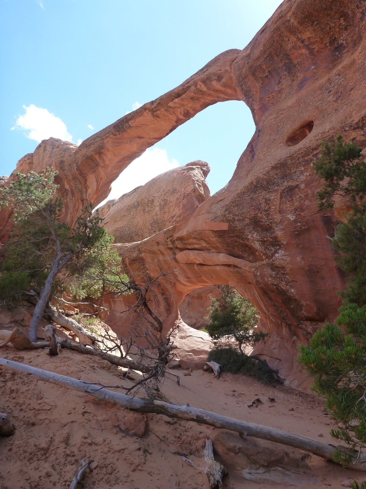
Every arch has a name, all 2000 known arches. So many so that rules about what an arch is had to be crafted to limit the 10's of thousands to ~2k. Even the rules are too pedantic to recite here but it's something about size greater then x and ....

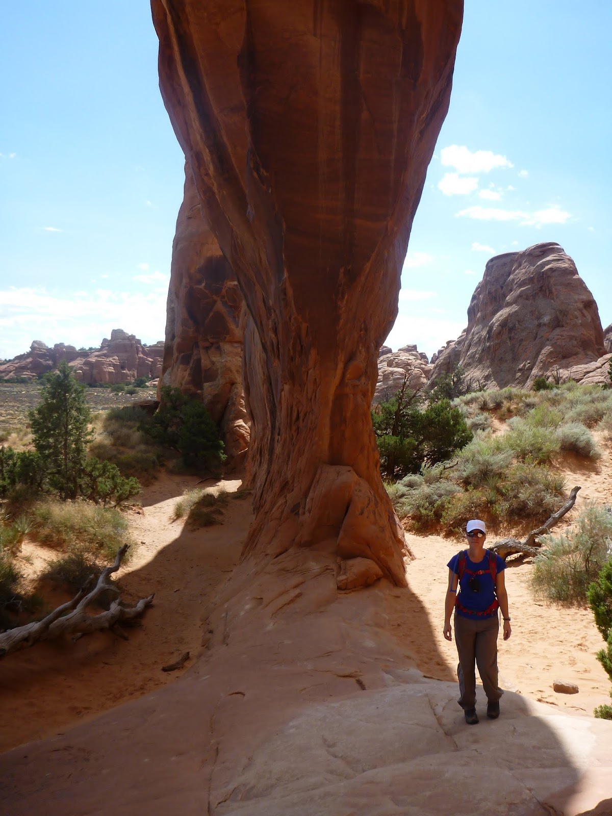


We have a few hours left on the hike so its time for some shade and a big snack. I attempt to gain the highest ground for lunch with a view, but she's not interesting in a scramble to the top. We settle for shade in a cool nest of rocks off the main trail for a snack.


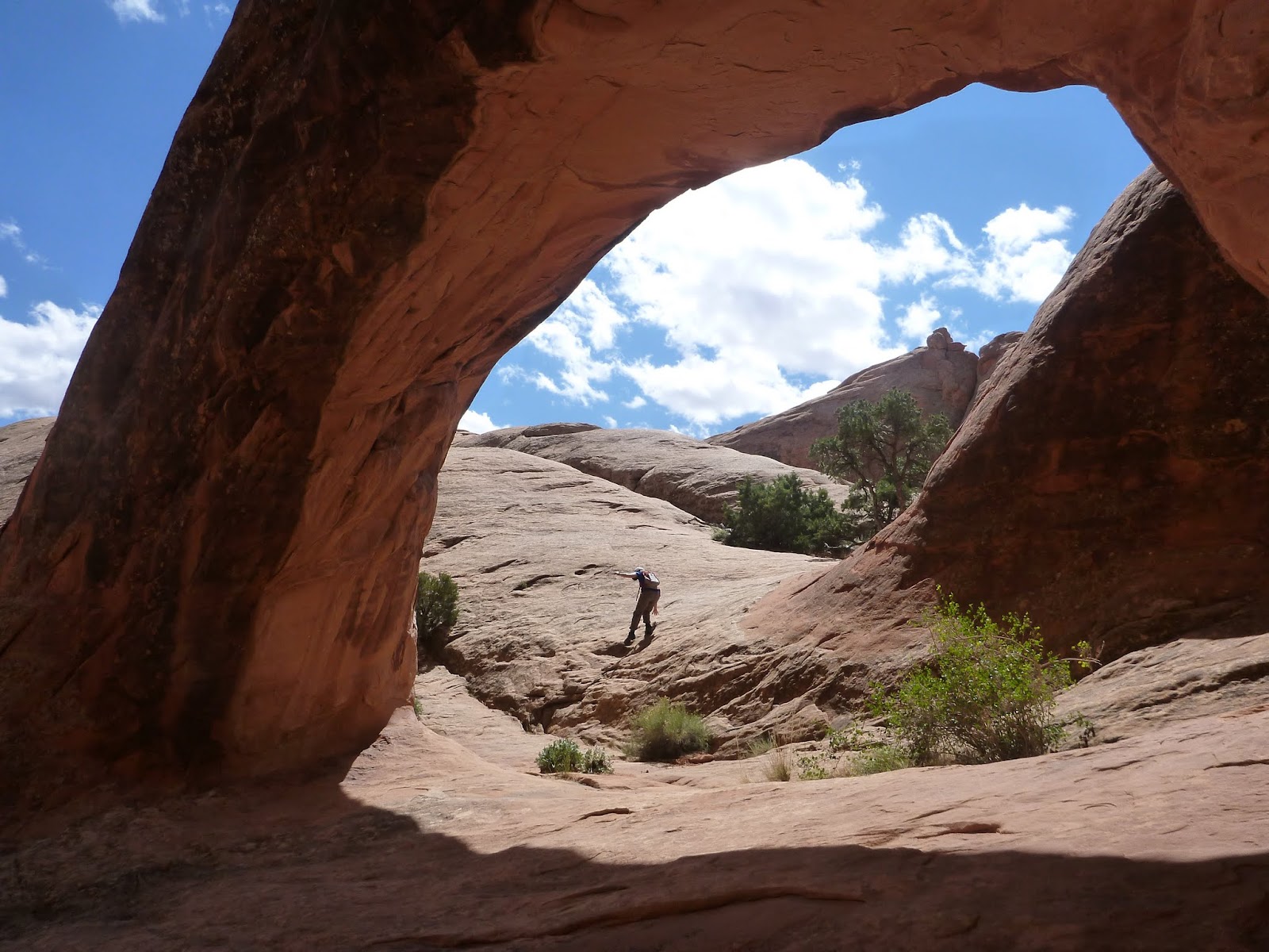
The high ridge line view I wanted at lunch arrives on the return trail.


The ridge walk on the way back and another hole in a rock.


When we finish the Devil's Garden we see people that didn't plan well or follow the huge sign telling people it's a long walk and they will need water. We see one gentleman in what could best be described as safari cloths, yet crying into his cell phone about "Please have water ready when I get to the car!" I'm surprised the cell phone works until I realize it's a handheld FM radio. This tool gets the clothes and radio but has no idea how to hike a few hours without running out of water.


3 of them are walking in line. Last(far left) is the most obvious. Middle is better from the other side and the front is the largest and you get a body and head/ear. It's actually pretty good.


We hike behind and around the Double Arch but nothing great. We hike out farther but get turned back when we see a road and figure the pull out parking lot is around the corner.


Moving to a new area, later in the day we acquire a parking spot for the RV (remember, we have to find oversize parking in a park packed with people). Into and Upto the ICON of the park, Delicate Arch.
A long, strenuous, trail awaits anyone wanting to see one of the most famous arches in the world. So much so, we are called upon to encourage others less fit or prepared to hike such and serious hill.
Early on we pass by the ranch of Mr. Wolfe. You can read if you'd like.


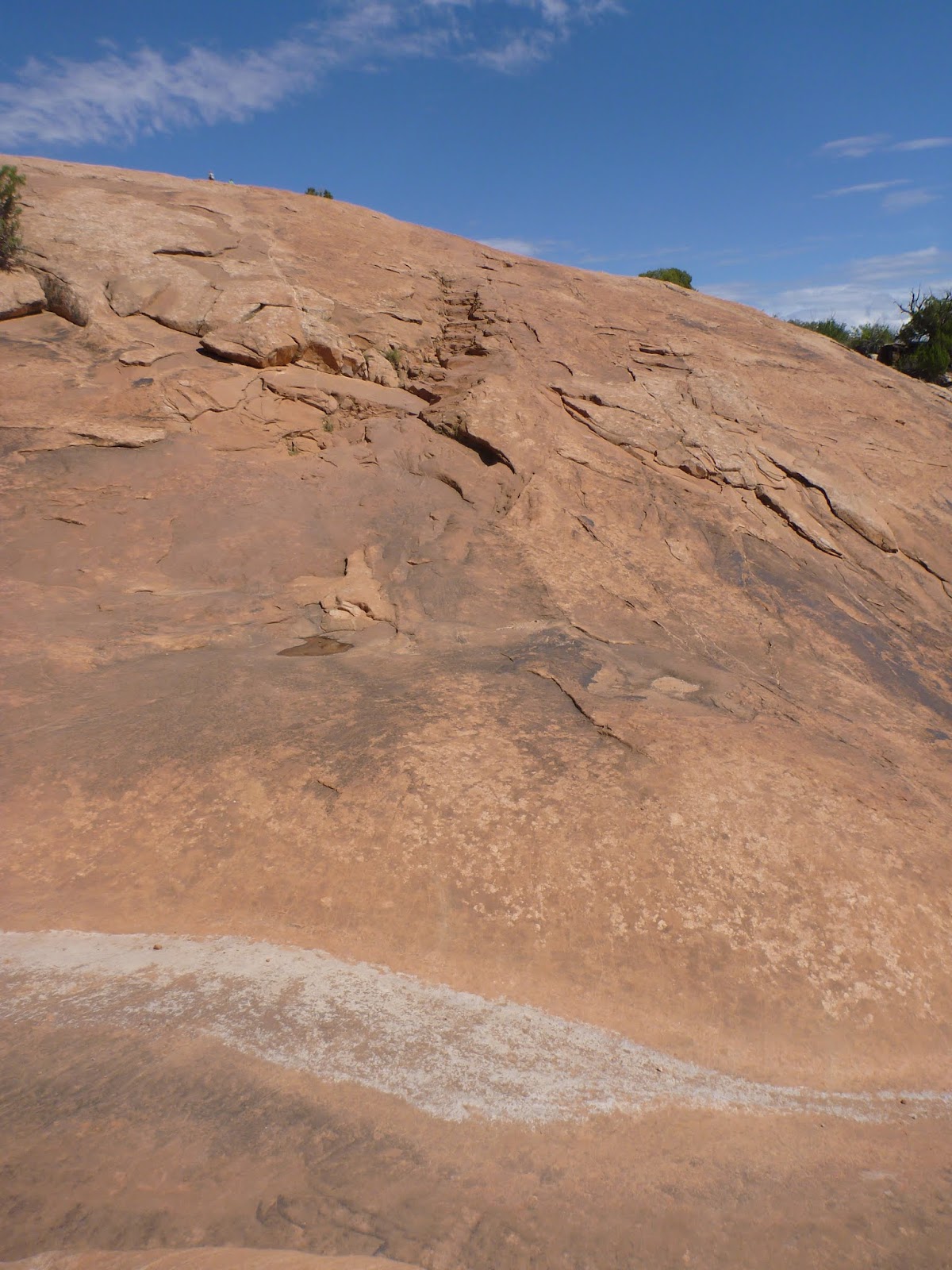
The climb starts and for the next hour we hike uphill.


Below: Carved steps make the trail less severe but it's still tiring.
Pow!

On to the next adventure and I really want my wife, Mrs Otter, to experience a true slot canyon and the hypnotic curves of sandstone bathed in pink light. I chose Little Wild Horse Canyon for it's easy access and it's spectacular design.


To "chimney up" means to stem out and walk up the walls to avoid deep narrow cracks, water holes or in this case, climb over a rock and avoid dropping down into a slot too narrow for humans.


This is to be expected but having the correct boots helps. These are the correct boots.


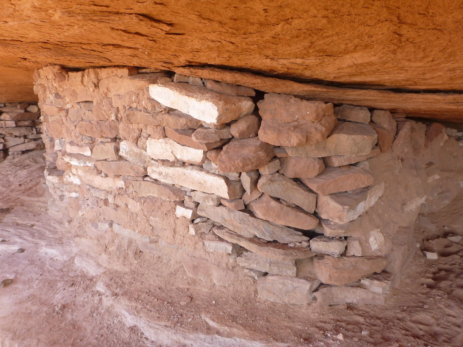
Again, it's down the road to the next item on the To Do list. This is a very easy road side hike to a Granary. I always find these interesting if you can see finger prints and bits of wood that are from ~1500 BC


Just like Arches, Once you get 30 minutes from the road, you are all alone.


Below is a canyon inside a canyon. Someplace in the middle is the White Rim Trail and from here you can see why it's called white rim. At the time I rode my bike around it I could not tell it was white, scale too large. Comment: Looks like a dinosaur footprint.


Back into Arches (we had to flip-flop days to make plans work) and a walk down Park Avenue Section. It's just as the name reports. Easy stroll for everyone, almost, it's not ADA but entering from both ends would avoid all or almost all the challenging steps.


Its the normal tour. Mostly stories and a pace so slow nobody falls behind. The terrain is serious but nothing we couldn't navigate. Finding all the features, probably not before we ran long and had to leave but then it would be on our own and it would mean more to find it ourselves.


Best part of ride and hike was the stop at Milt's for shakes and tater tots. We are on our way to the other end of town (maybe 8 miles) to an old mill to go swimming.

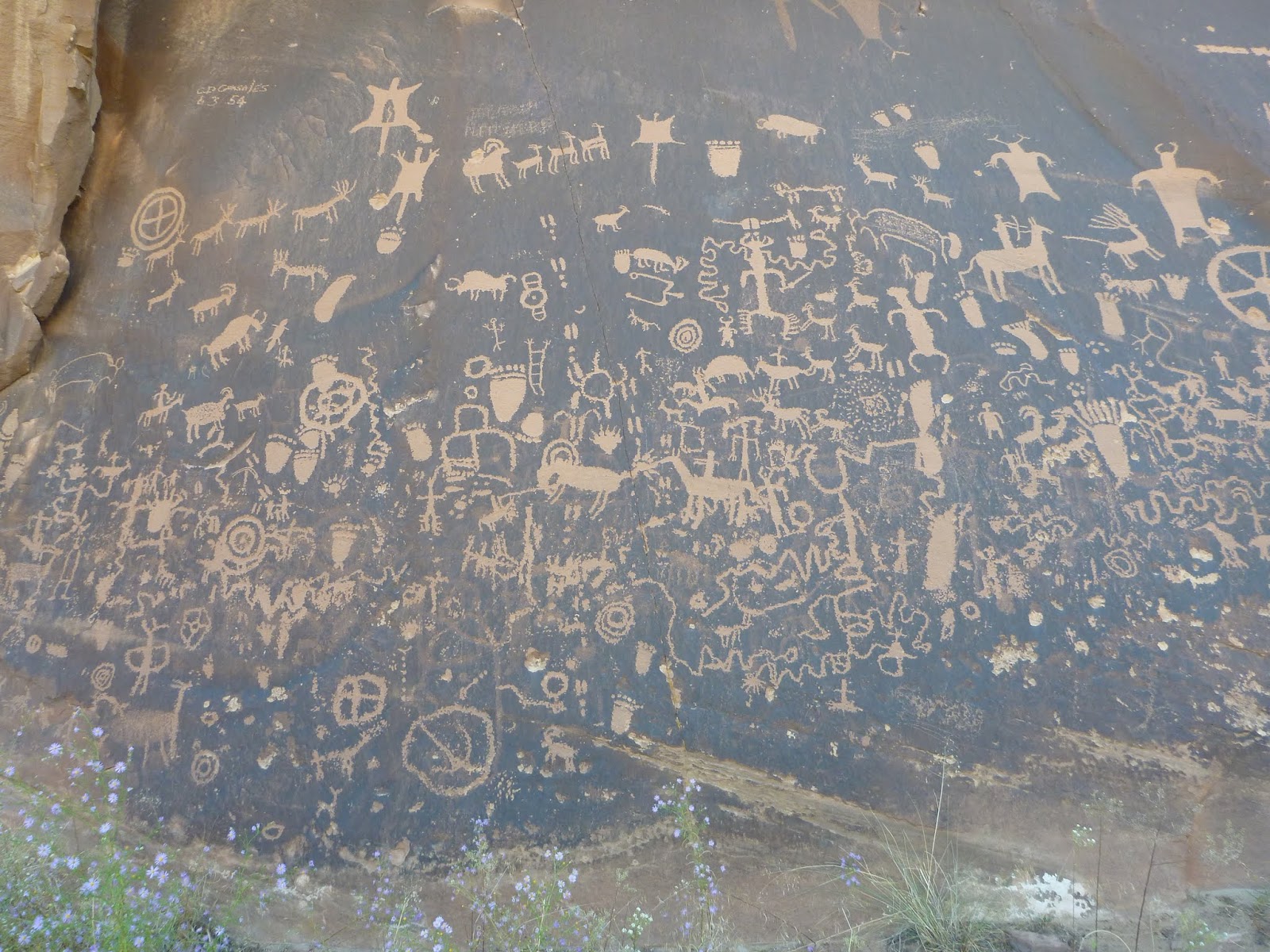
The next day we see Newspaper Rock and it does not disappoint. What you see is 2000 years old!


The park has a trail for Cave Springs and it includes these crazy awesome ladders.


It's time to leave the Canyonlands. We have one more night and a 20 hour drive home.


This is the last campsite just outside of Castle Rock. Until now we stayed at the RV Park in Moab. It was great. Each night we would return to our site, park and plug in. Clean up and walk minutes into downtown Moab for dinner and shopping. It was the best. We'd dine and walk around for a short time before returning to camp to update plans for the next day but the last night we did not have a site so we boondocked. I was excited to do some astronomy in the dark skies away from down but we just sat out in chairs and stared into the sky and reflected on the trip. All week we stared into the distant lands, distant past, and tonight we stared into the distant sky. Tomorrow we drive the long distance home and that's a 'good bye'.